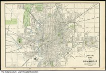
Map of Indianapolis, Indiana, circa 1910
| Description: |
The map ends at 38th street to the north, indicating the fairgrounds; Southern Avenue and Garfield Park are the furthest seen to the south; Tibbs and Fifth Street are seen to the west; and Line Street is the furthest street to the east on the map. The map was published by George F. Cram of Chicago. |
|---|---|
| Origin: | 1910, circa |
| Source: |
http://indianaalbum.pastperfectonline.com/photo/510AE6BA-6029-4B49-8D21-524815178300 |
| Collection: |
Indiana Album |
| Rights: | http://rightsstatements.org/vocab/CNE/1.0/ |
| Geography: |
Indianapolis, Marion County, Indiana, United States |
| Subjects: |
Joan Hostetler Collection Maps Indianapolis (Ind.) Marion County (Ind.) |
Further information on this record can be found at its source.


