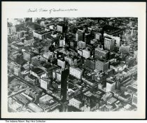
Aerial photo of downtown Indianapolis, Indiana, circa 1950
| Description: |
Aerial view taken southwest of downtown Indianapolis, looking northeast above Kentucky Avenue at buildings in the mile square. Monument Circle is near the center of the photo. Date of ca. 1929-1930 based on the construction of the Circle Tower building east of the Soldiers and Sailors Monument. |
|---|---|
| Origin: | 1930, circa |
| Source: |
http://indianaalbum.pastperfectonline.com/photo/BD5F42AF-3B55-432C-9ED8-541008558028 |
| Collection: |
Indiana Album |
| Rights: | http://rightsstatements.org/vocab/CNE/1.0/ |
| Geography: |
Indianapolis, Marion County, Indiana, United States |
| Subjects: |
Ray Hinz Collection Aerial photographs Skyscrapers Cities & towns Indianapolis (Ind.) Marion County (Ind.) |
Further information on this record can be found at its source.


